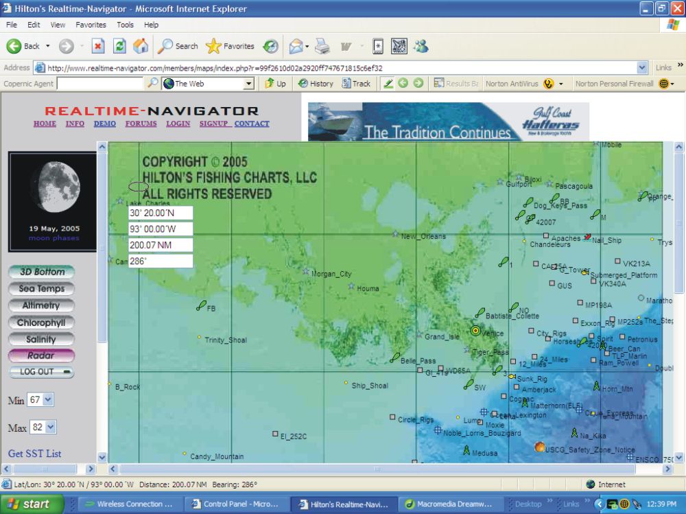
THE NAV TOOL
Below is the screen image when you go into the NC Gulf Region. The Nav Tool is located in the upper left of the screen - it's a transparent oval with 4 white boxes underneath showing the oval's lat/long position, distance and bearing from Venice (which is the default homeport, and is depicted by a bullseye as it's icon). You can change the location of the bullseye by clicking on the NAME of any waypoint - remember, the Nav Tool is always reading from the bullseye. Once you have placed the bullseye on the waypoint of your choice, then grab the oval on the Nav Tool and place it on any point of interest...it's important to remember that the program is actually reading from the tip of your cursor, so keep that in mind when trying to pinpoint the exact position of that tempbreak, water color change, waypoint, etc. Sometimes it helps to zoom in 1, 2, or even 3 times to get as exact as you can.
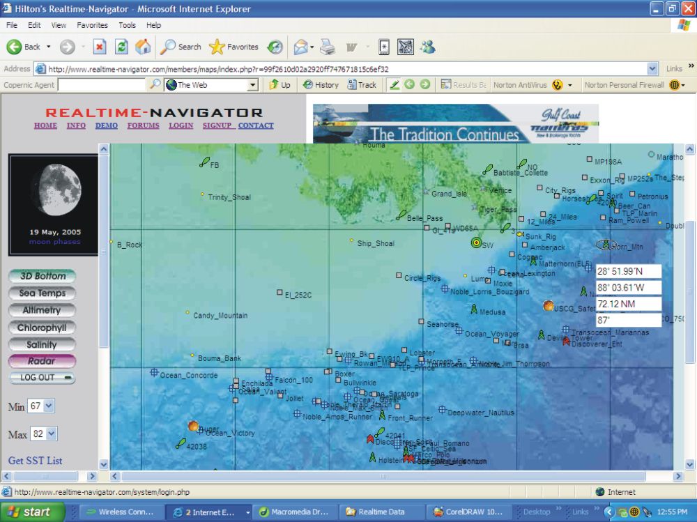
The next image shows that I have changed the location of the bullseye to be the SW Pass buoy, and have placed the Nav Tool on the Horn Mountain Spar, thus giving the lat/long position/ distance, and bearing to the spar from the buoy.